Spend less on herbicides. Act with precision. Harvest better results.
Smarter control, real savings.
Your next-level weed management starts here.
Agronomic Precision
Detect weeds as small as 3 cm, improving control accuracy, reducing application failures, and increasing overall efficiency.
Real-Time Processing
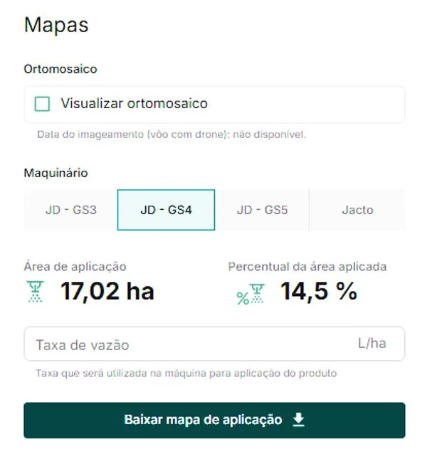
Receive a detailed prescription map highlighting infested areas and projected savings — ready to guide precise, localized spraying within 24 hours of drone flight.
Input Savings
Target post-harvest, pre-emergence, and post-emergence weeds with precision. Apply only where infestation is detected and save an average of 74% on herbicide use — for more sustainable and cost-effective farming.
Easy Sprayer Integration
Seamlessly transfer application maps to your sprayer monitor. Execute precision applications faster, with greater accuracy and less waste.
Unlock the power of Proximal
-

Imaging
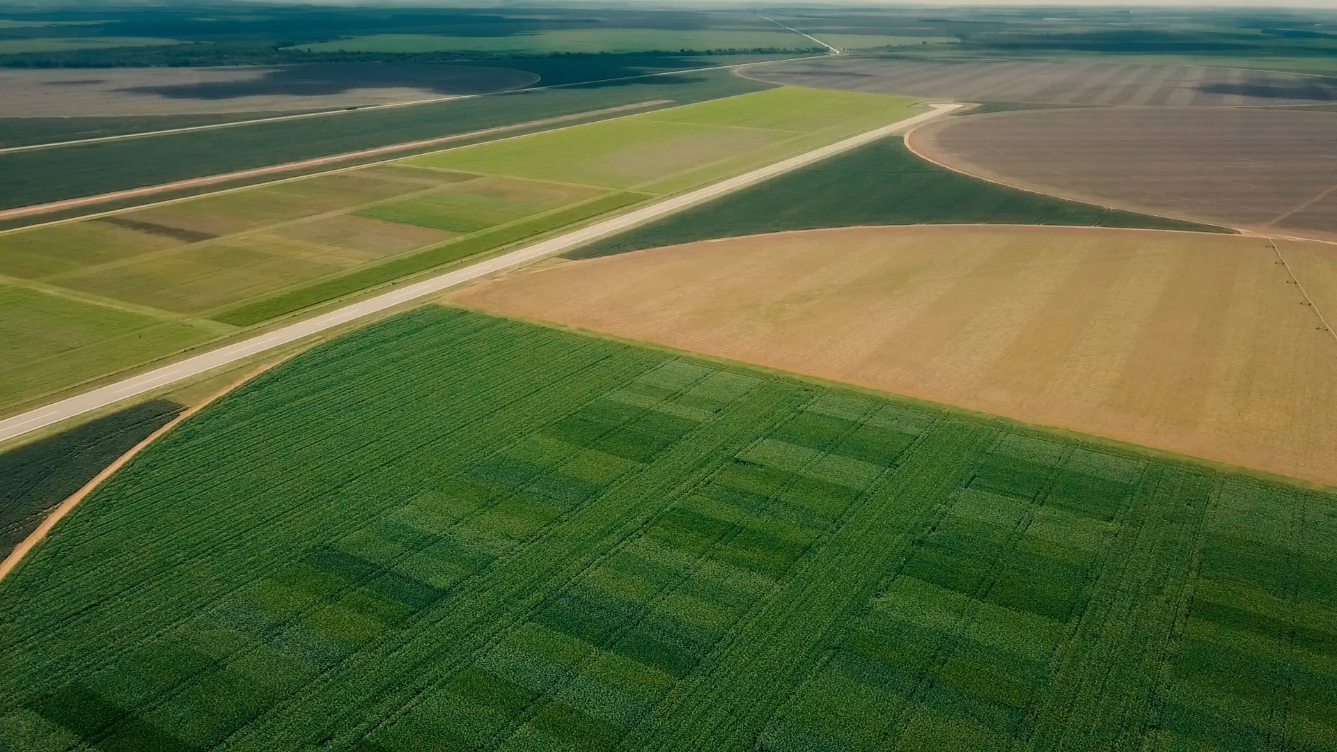
Drones equipped with high-resolution RGB cameras perform detailed mapping of your fields, capturing precise images for analysis.
-
Weed Identification
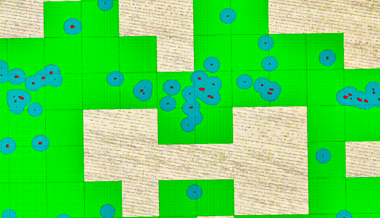
Moray’s proprietary AI identifies weeds as small as 3 cm, ensuring more effective control and minimizing waste.
-

Weed Detection
Detect weeds with high accuracy using drone-based, georeferenced images. Generate detailed prescription maps for precision application, improve operational efficiency, and reduce herbicide use — boosting your farm’s profitability.
-
Intuitive Interface
Within 24 hours, receive a digital prescription file via our online platform, where you can view your field and plan your application with ease.
-
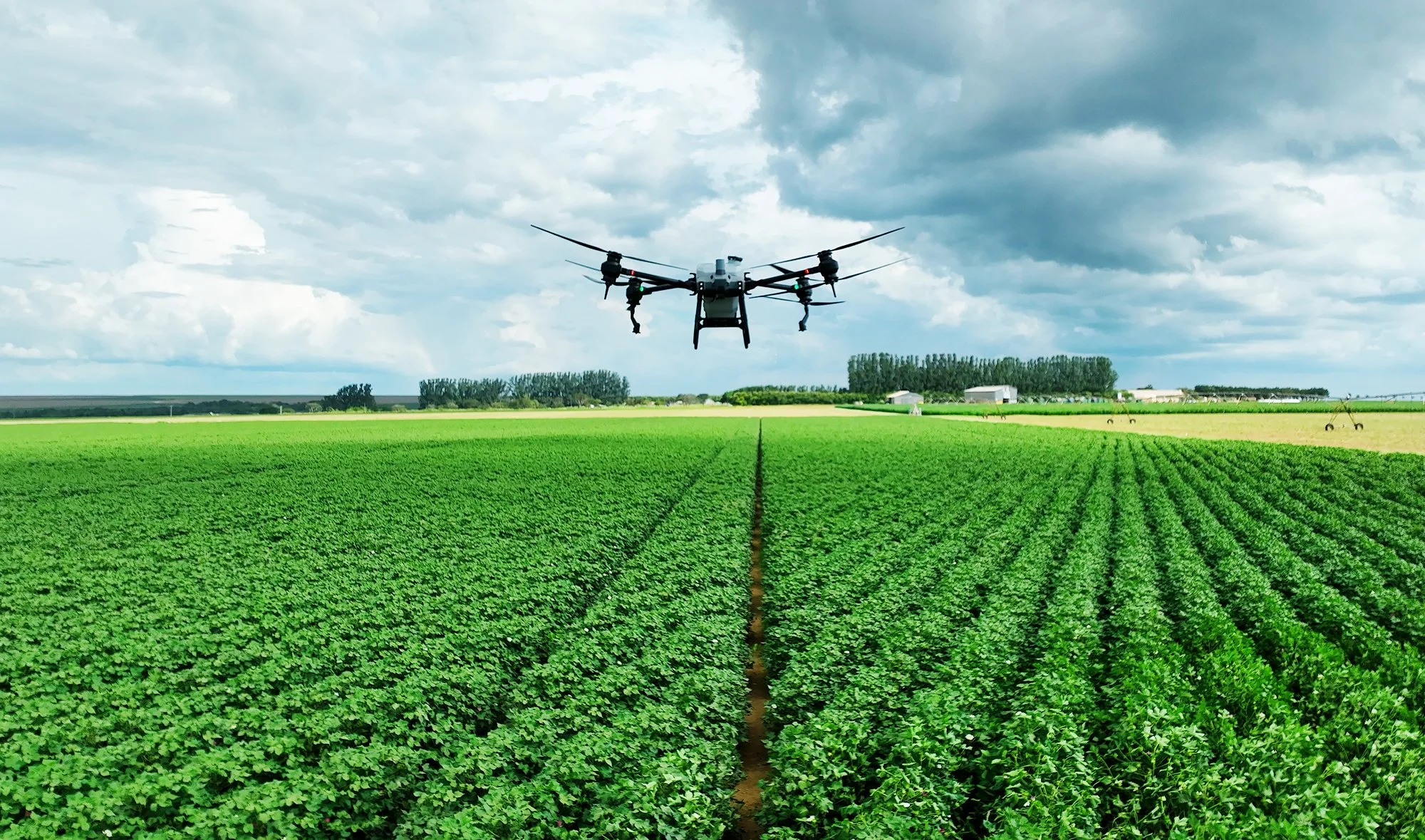
Precision Application
Proximal integrates with a variety of sprayers, delivering an average herbicide savings of 74% and enabling sustainable, intelligent weed management.
Package Comparison
| Feature | Digital Package | Full Package |
|---|---|---|
| Drone Flight for Imaging | ||
| Orthomosaic Generation | ||
| Orthomosaic Processing | ||
| Automated Weed Detection | ||
| Precision Application Map Generation |